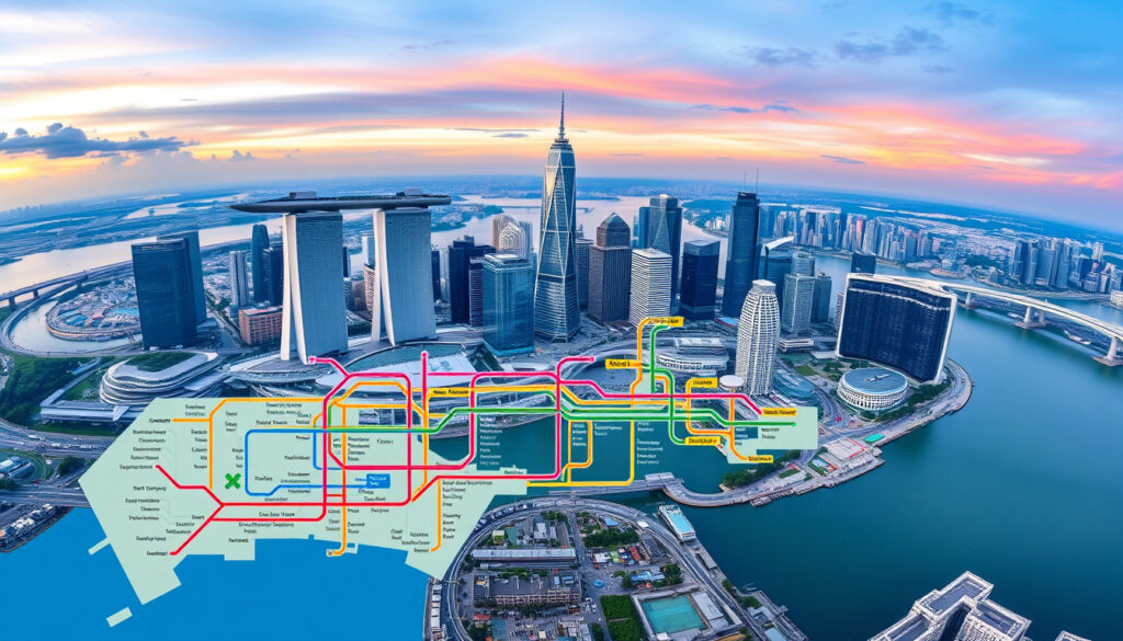
Map of Singapore MRT: Lines, PDF Download & Tourist Guide
Singapore’s MRT network spans 240km with 160+ stations across six color-coded lines, connecting Changi Airport directly to downtown via the East-West Line for under S$3. This guide covers how to read the map, which lines serve major tourist zones, payment methods without a transit card, and where to download official PDFs for offline navigation.
Main MRT Lines: North-South, East-West, North East, Circle, Downtown, Jurong Regional · Airport Connection: Yes, Changi Airport MRT Station · Operators: LTA, SMRT · LRT Systems: Bukit Panjang, Sengkang, Punggol · Map Formats: PDF, interactive, high resolution
Quick snapshot
- 6 MRT lines covering 240km with 160+ stations (Land Transport Authority)
- Changi Airport directly served by East-West Line (LTA System Map PDF)
- Maps in English, Chinese, Malay, Tamil from LTA (Land Transport Authority)
- Exact opening dates for 2026 new stations (Land Transport Authority)
- Full scope of 2050 expansion network (Land Transport Authority)
- LTA map Ver280225 released February 2025 (LTA System Map PDF)
- Under-construction stations marked U/C on official maps (LTA System Map PDF)
- Jurong Regional Line opening in coming years (Land Transport Authority)
- Ongoing rail expansions across the island (Land Transport Authority)
Singapore’s transit authority publishes network statistics and downloadable maps in four languages. The comparison below summarizes key metrics from official LTA data.
| Metric | Value | Source |
|---|---|---|
| Total MRT Lines | 6 (NS, EW, NE, Circle, Downtown, Jurong Regional) | LTA Rail Network |
| Network Length | 240 km | LTA Rail Network |
| MRT Stations | 160+ | LTA Rail Network |
| Daily MRT Ridership | 3 million+ | LTA Rail Network |
| LRT Stations | 40+ | LTA Rail Network |
| LRT Network Length | 28 km | LTA Rail Network |
| LRT Daily Ridership | 200,000+ | LTA Rail Network |
| Airport Served | Changi via East-West Line | LTA System Map PDF |
| Official Maps | LTA PDF, SMRT interactive | SMRT Journey MRT Network Map |
| Map Versions | English (720kB), Chinese (818kB), Malay (757kB), Tamil (1MB) | Land Transport Authority |
How to use MRT in Singapore for tourists?
Singapore’s MRT maps use bold colors and line styles to distinguish each route, making the system accessible even if you’ve never ridden before. Every line is named by color, and interchange stations appear as dots where two or more lines meet—a visual shorthand the Land Transport Authority (Singapore’s transit regulator) designed specifically for clarity.
Getting tickets and fares
Tourists can ride using contactless credit or debit cards with Mastercard or Visa logos—no need to buy a separate card. Apple Pay, Google Pay, and Samsung Pay work the same way, letting you tap in and out at gate readers just like you would at a retail store.
The same cards work across MRT, LRT, and public buses under Singapore’s contactless payment integration. For regular users, the SimplyGo app (Land Transport Authority’s ticketing platform) offers another digital option.
Navigating with the map
On official LTA maps, each line has a unique color band: red for North-South, green for East-West, purple for North East, orange for Circle, blue for Downtown, and teal for the upcoming Jurong Regional Line. Stations show as dots; larger dots mark interchange points where you can switch lines.
Upcoming stations under construction appear with a “U/C” (under construction) notation on the LTA’s Version 280225 map from February 2025. The interactive map at LTA’s train map page lets you click any station for real-time arrival data and route planning.
Key lines for tourists
Five MRT lines cover Singapore’s main tourist zones, each connecting distinct areas:
- North-South Line (red): Orchard Road shopping district, Raffles Place CBD, Sentosa via transfer
- East-West Line (green): Changi Airport, Gardens by the Bay, Singapore Flyer
- Circle Line (orange): Marina Bay Sands, Clarke Quay, Botanic Gardens
- North East Line (purple): Chinatown, HarbourFront (Sentosa monorail transfer)
- Downtown Line (blue): Little India, Bugis, Marina Bay area
Train frequency runs every 2-5 minutes during peak hours and 5-7 minutes off-peak, per 99.co (Singapore property portal). Services start around 5:30 AM and run until approximately midnight daily, with extended hours on public holidays.
The implication: tourists can rely on the MRT’s high frequency to eliminate wait-time anxiety, even when navigating unfamiliar transfers between lines.
Tourists from countries with contactless banking (most of Europe, Australia, Canada) can use their existing cards straight away—no tourist card needed, no app download required.
Does Singapore MRT go to the airport?
Yes—Changi Airport has its own MRT station on the East-West Line, making it one of the most convenient airport connections in Asia. Rather than paying S$20-30 for a taxi, tourists can reach downtown in under an hour for less than S$3.
Changi Airport MRT Station access
Changi Airport Station sits at the eastern terminus of the East-West Line. Trains run roughly every 5-10 minutes to the airport from Tanah Merah Station, where you transfer if coming from downtown. The journey from downtown to Changi takes approximately 45-60 minutes depending on your starting point.
The station has check-in facilities for Singapore Airlines and Scoot airlines on the city side at some downtown stations, letting you drop bags before heading to the airport.
Travel options via subway
Four ways exist to reach Changi from Singapore’s center: MRT (East-West Line), taxi, rideshare, or hotel shuttle. MRT is by far the most cost-effective at under S$3 per ride, and there’s no traffic delay. A taxi costs S$20-45 depending on time of day, while Grab rideshare typically runs S$25-35.
For budget travelers landing at Changi, the MRT East-West Line connection means you can reach Orchard Road hostels or Bugis budget hotels in 45 minutes for the price of a coffee. That’s a significant saving over 10-15 trips.
What is the difference between MRT and LRT in Singapore?
Two separate rail systems operate under the broader “train” umbrella: the Mass Rapid Transit (MRT) carries the heavy load, while the Light Rail Transit (LRT) serves as a neighborhood feeder to residential estates. Understanding which system you’re on prevents confusion when planning routes.
MRT vs LRT lines and coverage
The MRT spans 240 kilometers across six lines with 160+ stations, handling 3 million+ daily riders. By contrast, the LRT covers 28 kilometers with 40+ stations and moves 200,000+ daily riders—roughly 10% of MRT volume, according to Land Transport Authority data.
What this means: tourists rarely interact with the LRT, but confusion between the two systems can lead to routing errors if you don’t check which line serves your station.
| Feature | MRT | LRT |
|---|---|---|
| Network Length | 240 km | 28 km |
| Stations | 160+ | 40+ |
| Lines | 6 (NS, EW, NE, Circle, Downtown, Jurong Regional) | 3 (Bukit Panjang, Sengkang, Punggol) |
| Daily Ridership | 3 million+ | 200,000+ |
| Role | Main corridor transit | Neighborhood feeder |
| Train Length | 6-8 cars standard | 2 cars standard |
| Fully Automated | No (driver-attended) | Yes (unattended) |
Usage for tourists
Tourists rarely need the LRT—the system’s three lines serve suburban housing estates (Bukit Panjang, Sengkang, Punggol) that lie outside typical tourist zones. If you’re visiting Sentosa, Marina Bay Sands, Chinatown, or Orchard Road, the MRT covers everything without an LRT transfer.
The LRT connects to MRT at three interchange stations: Bukit Panjang (connects to Downtown Line), Sengkang, and Punggol. In practice, these tend to serve residents returning from work or residents heading to suburban malls—visitors to Singapore’s core attractions will find the MRT sufficient.
If your hotel is in a suburban area near Sengkang or Punggol, you’ll take an LRT feeder ride to reach the main MRT network. But Singapore’s official tourism district concentrates around the city center where the MRT alone suffices.
What is the best way to get around Singapore as a tourist?
The MRT covers all major tourist zones—Sentosa, Orchard Road, Marina Bay, Chinatown, Little India—making it the most efficient option for visitors. The network’s 160+ stations mean most destinations fall within a 10-minute walk of an MRT entrance.
MRT advantages
Three factors make the MRT preferable to taxis or rideshares for tourists. First, flat-fare pricing keeps costs low—most downtown trips cost S$0.80-2.00 regardless of distance. Second, no traffic delays mean predictable journey times. Third, the color-coded map makes route planning visual rather than address-based.
The VisitSingapore Explorer Guide (Singapore’s official tourism authority) recommends the MRT for visitors, noting that maps and ticketing support are available at every station and at the Singapore Visitor Centre.
Map integration with buses
Singapore’s bus network interlinks with MRT at almost every station—feeder buses serve residential zones while trunk routes run along major roads. LTA’s SimplyGo system covers both bus and rail fares on a single card or contactless payment method, meaning you never need separate accounts for different transit modes.
The Google Play app Singapore Metro Map & Guide provides offline MRT/LRT maps for tourists without data connectivity, sourced from official LTA data.
Some international cards—particularly those issued in the US or Europe—may require PIN verification for transit charges. Check with your bank before travel if your card has been flagged for international contactless use. Most card issuers now support seamless transit tapping without additional verification steps.
How to pay for MRT in Singapore for tourists?
Singapore’s transit payment system accepts contactless bank cards and mobile wallets directly at fare gates—no separate tourist card required if your card has contactless capability. This streamlined approach means visitors can board within seconds of arriving at the platform.
Contactless credit/debit cards
The EZ-Link contactless integration accepts any Mastercard, Visa, or UnionPay card with tap-to-pay functionality. You tap at the station entrance and tap again at your destination—fares deduct automatically. International cards work identically to cards issued by Singapore banks.
This differs from systems like London’s Oyster or Tokyo’s Suica where you load value onto a transit-specific card. Singapore’s system treats your bank card as the transit card, eliminating the need for a separate purchase.
Mobile payments
Apple Pay, Google Pay, and Samsung Pay integrate with MRT/LRT gates through the same contactless mechanism. The process works the same as tapping a physical card—open your wallet app, hold your phone near the reader, and proceed.
The SimplyGo app (available on iOS and Android) offers another digital path, letting tourists register and purchase transit passes without a physical card. The 99.co guide to MRT maps notes that SimplyGo is the government’s recommended ticketing app for visitors who want digital receipts and trip tracking.
Upsides
- Contactless cards and mobile wallets work directly—no separate purchase needed
- Flat-fare pricing keeps costs predictable (S$0.80-2.00 for most downtown trips)
- 240km MRT covers all major tourist zones without transfers
- Maps available in four languages from LTA
- High train frequency (2-5 min peak) minimizes wait times
Downsides
- LRT feeder system serves only suburban areas (tourists rarely need it)
- Some international cards may require PIN setup for transit charges
- No direct MRT connection to some hotel zones in Sentosa (requires monorail transfer)
- Maps update periodically—always verify station status at LTA.gov.sg
Download official Singapore MRT map PDFs
Three official sources offer downloadable MRT system maps for offline use: the Land Transport Authority, SMRT (the operator), and third-party aggregators that republish LTA data. For accuracy and latest updates, official sources rank first.
- Land Transport Authority Rail Network page: Primary source for all MRT and LRT maps in English, Chinese, Malay, and Tamil. Download links for PDF versions appear at the bottom of the page.
- LTA System Map PDF (Version 280225): Direct link to the official February 2025 system map showing all operational lines, stations, and under-construction notations.
- SMRT Journey MRT Network Map: SMRT’s operator-specific map showing their service lines with the journey planner integrated.
- VisitSingapore Explorer Guide PDF: Official tourism authority guide that integrates MRT maps with tourist attractions and visitor centre locations.
“Today, more than 160 stations across six MRT lines span the island. This 240km system has over three million daily ridership.”
“Stay updated with the latest MRT map from the official Singapore Land Transport Authority (LTA), which includes all stations, operational lines, and an explanation for each legend and symbol on the map.”
Related reading: Changi Airport Terminal 3 Map · Singapore Weather Radar Live
Tourists navigating the color-coded lines to key spots like the airport will find the Singapore MRT line map PDF invaluable for spotting 2026 expansions early.
Frequently asked questions
What is the prettiest MRT station in Singapore?
Subjective, but Tiong Bahru Station (Red Line) frequently ranks highest for its mid-century modernist architecture and the nearby Tiong Bahru Estate’s heritage value. Bras Basah (Circle Line) and Farrer Park (North East Line) also draw architecture enthusiasts for their cultural-zone design.
Where to download Singapore MRT map PDF?
Download from the Land Transport Authority Rail Network page—the official source with maps in four languages. SMRT’s journey planner site also offers downloadable maps.
Is there a Singapore MRT app?
Several options serve different purposes. The Singapore Metro Map & Guide app on Google Play offers offline maps. SMRT Connect and MyTransport (LTA’s official app) provide real-time train arrivals and service updates.
Does MRT cover all tourist attractions?
The MRT covers the vast majority of tourist zones: Orchard Road, Marina Bay Sands, Gardens by the Bay, Chinatown, Little India, Clarke Quay, and Sentosa (via HarbourFront transfer). Exceptions include some resort-area hotels on Sentosa Island, which require a short monorail ride from HarbourFront.
How to get a high resolution Singapore MRT map?
The LTA PDF at Version 280225 is the highest resolution official map available, designed for print-quality output. File sizes: English 720kB, Chinese 818kB.
What are the latest MRT map updates?
The most recent LTA system map (Version 280225) dates to February 28, 2025. It shows six MRT lines including the new Jurong Regional Line segment under construction, with U/C markers for upcoming stations.
Can I use my credit card on MRT in Singapore?
Yes—contactless credit and debit cards with Mastercard, Visa, or UnionPay logos work directly at MRT fare gates. Apple Pay, Google Pay, and Samsung Pay also work identically. No separate transit card is required unless you prefer the SimplyGo card for trip tracking.
More related posts
 Monaco vs Man City: Head-to-Head, Results & Highlights
 Maris Stella Primary: All-Boys Catholic SAP School
 Lee Jung-eun: From Stage Veteran to Parasite Icon
 2026 Fan Tai Sui: Which Zodiac Signs Offend and How to Appease
 English to Malay Translation: Best Free Tools Guide
 Mega Personal Tentonraten USA: Verified Guide & Safety Tips 2025
 ITE Work-Study Diploma: Is It Good? Requirements, Salary & More
 Man City vs Tottenham: Head-to-Head Record & Controversies